Transcribed from the 1886 Religious Tract Society edition by DavidPrice, email ccx074@coventry.ac.uk
THE R. T. S. LIBRARY—ILLUSTRATED
ADVENTURES IN NEW GUINEA
by
JAMES CHALMERS
of port moresby
WITH SIX ILLUSTRATIONS
THE RELIGIOUS TRACT SOCIETY
56, Paternoster Row; 65, St. Paul’s Churchyard;
and 164, Piccadilly
1886.
p. 4london:
printed by william clowes and sons, limited,
stamford street and charing cross.
p. 7INTRODUCTION.
Public attention has been repeatedly and prominently directed toNew Guinea during the last few months. The name often appearsin our newspapers and missionary reports, and bids fair to take a somewhatprominent place in our blue-books. Yet very few general readerspossess accurate information about the island itself, about the workof English missionaries there, or about the part New Guinea seems destinedto play in Australian politics. Hence a brief sketch indicatingthe present state of knowledge on these points will be a fitting introductionto the narratives of exploration, of adventure, and of Christian workcontained in this volume.
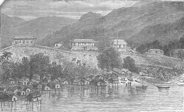
New Guinea, if we may take Australia as a continent, is the largestisland in the world, being, roughly speaking, about 1400 miles long,and 490 broad at its widest point. Its northernmost coast nearlytouches the equator, and its southernmost stretches down to 11°south latitude. Little more than the fringe or coastline of theisland has been at all carefully explored, but it is known to possessmagnificent mountain ranges, vast stretches of beautiful scenery, muchland that is fruitful, even under native cultivation, and mighty riversthat take their rise far inland. Its savage p. 8inhabitantshave aroused powerfully the interest and sympathy alike of ChristianPolynesians and English missionaries, who, taking their lives in theirhands, have, in not a few instances, laid them down in the effort towin New Guinea for Christ.
At some remote period of the past, New Guinea, in all probability,formed a part of Australia. Torres Strait itself is only aboutsixty miles wide; the water is shallow; shoals and reefs abound, givingthe sailor who threads the intricate and dangerous navigation the impressionthat he is sailing over what was once solid earth.
The first European sailor who sighted the island was D’Abreu,in 1511; the honour of being first to land belongs most probably tothe Portuguese explorer, Don Jorge De Meneses, in 1526, on his way fromMalacca to the Moluccas.
Into the somewhat intricate history of the connection of the Dutchwith the north-west coast of New Guinea we cannot here enter. As suzerain nominally under the Sultan of Tidore, they claim possessionof the western part of the island as far east as Lat. 141° 47' E. The trade they carry on is said to be worth about 20,000l. ayear. Dutch missionaries have for many years been stationed aroundthe coast of Geelvink Bay.
In 1770, Captain Cook visited the south-west coast, and in 1775,an English officer, Forrest by name, spent some months on the north-eastcoast in search of spices. In 1793, New Guinea was annexed bytwo of the East p. 9IndiaCompany’s commanders, and an island in Geelvink